Info about Tanudan, Cordillera Administrative Region (Philippines)
Tanudan region is Cordillera Administrative Region, Kalinga, situated in Philippines (PH).
latitude is 17.2955600, and longitude 121.2377800.
Tanudan has a population of 8.119 people, this place timezone is Asia/Manila (Asia/Manila_cet).
Tanudan is popular for kayaking around Philippines.
.
More details about Tanudan in Philippines (PH)
It’s time zone is UTC+08:00 (for standard time).
Population for Tanudan is 8.119 citizens, according to 2007 last census. You need to call local telephones. Local dialing code for Tanudan is 74. It’s zip code is 3805, this is why for sending postcards to friends on your travel this can be done by using the post code as per description.
Tanudan size is 307 sq. kilometers so Tanudan is a medium size city, in our opinion a city worth a visit. If you stay in this town you can save money because of their economic housing costs, so this is why you could have it as a base in order to move across Philippines or Tanudan near places.
Its height above sea level, that is meters above mean sea level (MAMSL), should be about 1166 mt. Because of this this is the perfect place when you want high areas to visit for your next holiday and want to do mountain rails if on a travel abroad.
Near cities are astonishing cities like Tabuk, Natonin. This is why you could easily reach those other travel destinations for new adventures.
Köppen climate classification in this city is tropical rainforest climate.
If you need detailed information on this city please check their website http://www.tanudan.gov.ph/.
Tanudan things to do and activities: best trip destination for:
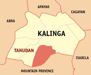
Interactive Tanudan (Philippines) Map and attractions
Interactive map of Tanudan, Cordillera Administrative Region Kalinga Philippines (PH).
