Info about Zamora, Estado de Michoacán de Ocampo (Mexico)
Zamora is a place of Estado de Michoacán de Ocampo, with country Mexico (MX).
Also called Samora-de-Idal’go, ZMM, Zamora, Zamora de Hidalgo, Самора-де-Идальго, its latitude is 19.9855000, and its longitude -102.2838700.
In Zamora are settled 141.627 citizenry, its timezone is America/Mexico_City (America/Mexico_City_cet).
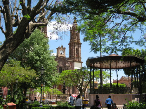
In your trip to Zamora you can do architectural buildings in Mexico.
.
More details about Zamora in Mexico (MX)
It is the capital of Zamora Municipality.
Zamora population is 141.627 residents, related to 2010 census. Zamora postal code is 59600–59699, this is why for post delivery from Zamora it can be used this zip code as per description.
Zamora altitude above sea level, basically meters above mean sea level (MAMSL), should be about 1569 meters. For this reason Zamora is the perfect travel destination if you and your family want high land to visit for your next holiday and love mountain rails while you are on a trip abroad.
If you want extra data for Zamora please check their website http://www.zamora.gob.mx.
Zamora things to do and activities: best trip destination for:
Interactive Zamora (Mexico) Map and attractions
Interactive map of Zamora, Estado de Michoacán de Ocampo Mexico (MX).
