Info about Ixtapa-Zihuatanejo, Estado de Guerrero (Mexico)
Ixtapa-Zihuatanejo is a of Estado de Guerrero, with country Mexico (MX).
Ixtapa-Zihuatanejo names are also Ixtapa Zihuatanejo, Ixtapa-Zihuatanejo, Jose Azueta, José Azueta, Siuatanekho, ZIH, Zihuatanejo, khwzh azwta gwyrrw, xi wa ta nei huo, Сиуатанехо, خوزه ازوتا، گوئررو, 锡瓦塔内霍, its latitude is 17.6434400, and its longitude -101.5521200.
In Ixtapa-Zihuatanejo there are 67.408 citizens, this area timezone is America/Mexico_City (America/Mexico_City_cet).
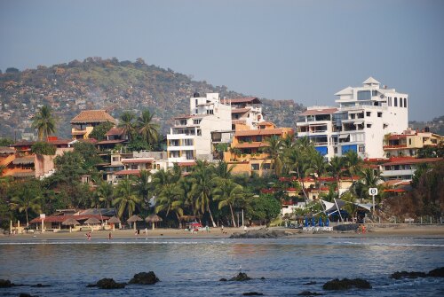
In your trip to Ixtapa-Zihuatanejo you can do beaches, swimming, events, walkways, sailboats, towers, historical sites in Mexico.
.
More details about Ixtapa-Zihuatanejo in Mexico (MX)
It is the capital of Zihuatanejo de Azueta Municipality.
It has timezone UTC−06:00 (valid in period standard time).
In Ixtapa-Zihuatanejo live 67.408 citizens, related to 2010 last census. Do You are looking to have a call local people! If you want to call local numbers in Ixtapa-Zihuatanejo you can use 755 as local dialing code. Ixtapa-Zihuatanejo postal code is 40880, this is why if you want to send anything to your friends by post in Ixtapa-Zihuatanejo it can be used 40880 zip code as per description above.
Ixtapa-Zihuatanejo meters above sea level, or meters above mean sea level (MAMSL) is over 20 meters above sea. That is why it is the perfect trip destination when you and family love plain ground to see for your next holiday.
For information for Ixtapa-Zihuatanejo you can have a look at its official webpage http://zihuatanejodeazueta.gob.mx/inicio/.
Ixtapa-Zihuatanejo things to do and activities: best trip destination for:
Interactive Ixtapa-Zihuatanejo (Mexico) Map and attractions
Interactive map of Ixtapa-Zihuatanejo, Estado de Guerrero Mexico (MX).
