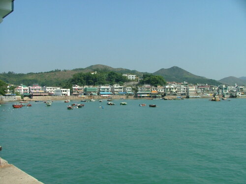
Info about Yung Shue Wan, (Hong Kong)
It is also called Rongshu Wan, Yung Shu Wan, Yung Shue Wan, rong shu wan, 榕树湾, 榕樹灣, its latitude is 22.2262300, and longitude is 114.1124100.
In Yung Shue Wan there are 6.000 inhabitants, this city timezone is Asia/Hong_Kong (Asia/Hong_Kong_cet).
Yung Shue Wan is famous for activities like caves, islands, snorkeling, bodyboard, walkways, swimming, walking trails, hiking, off-road trails, hiking trails, climbing, beaches, scenic roads, hunting, horse trails, mountains, countryside, forest, national parks, parks, historical sites, docks, fishing, sailboats, nature, natural places, running, ancient ruins, statues, towers, volcanoes, aquariums, farms, nature reserves, fountains, adventure, playgrounds, gardens, trail running, monuments, castles, valleys, slopes, rivers in Hong Kong.
.
More details about Yung Shue Wan in Hong Kong (HK)
Yung Shue Wan time zone is UTC+08:00 (valid for standard time).
Yung Shue Wan height above mean sea level, also called meters above mean sea level (MAMSL), should be about 0 meters. For this this is an ideal trip destination when you and family like to do a trip near the sea.
Yung Shue Wan things to do and activities: best trip destination for:
Interactive Yung Shue Wan (Hong Kong) Map and attractions
Interactive map of Yung Shue Wan, Hong Kong (HK).
