Info about Tamasopo, Estado de San Luis Potosí (Mexico)
Tamasopo is a town in Estado de San Luis Potosí, in country Mexico (MX).
It is also called La Palma, Palma, Tamasopo, its latitude is 21.9242600, and its longitude is -99.3936500.
Tamasopo has a population of 4.326 residents, Tamasopo timezone is America/Mexico_City (America/Mexico_City_cet).
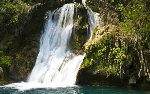
In your trip to Tamasopo you can do geological formations, caves, secret, gardens, lakes around Mexico.
.
More details about Tamasopo in Mexico (MX)
Tamasopo time zone is UTC−06:00 (valid in period standard time).
Tamasopo meters above mean sea level basically meters above mean sea level (MAMSL), is under 721 meters. For this it is a perfect destination if you and your family want tall mountains to visit in your next travel and love mountain rails walking when on a travel to visit new places.
Tamasopo things to do and activities: best trip destination for:
Interactive Tamasopo (Mexico) Map and attractions
Interactive map of Tamasopo, Estado de San Luis Potosí Mexico (MX).
