Info about Uruapan, Estado de Michoacán de Ocampo (Mexico)
Uruapan is a location in Estado de Michoacán de Ocampo, in Mexico (MX).
Also called Opstina Uruapan, Opština Uruapan, Ourouapan, UPN, Uruapan, Uruapan del Progreso, awrwapan, uluapan, wu lu a pan, Ουρουάπαν, Уруапан, Уруапан дел Прогресо, اورواپان, 烏魯阿潘, 우루아판, its latitude is 19.4111600, and longitude is -102.0564400.
With a population of 334.749 inhabitants, this area timezone is America/Mexico_City (America/Mexico_City_cet).
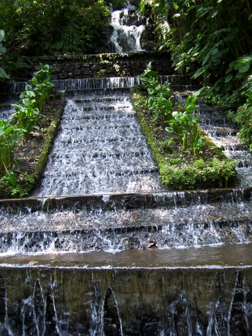
For your trip to Uruapan you can hiking, hiking trails, walking trails, volcanoes, national parks in all Mexico.
.
More details about Uruapan in Mexico (MX)
It is located in time zone UTC−06:00 (in standard time).
Population of Uruapan is 334.749 residents, if we consider 2015 last census. You are looking to have a call local phone numbers. You can use 452 as local dialing code for local phone numbers.
Uruapan elevation above mean sea level, basically meters above sea level (M A.S.L.), is about 1871 mt. For this reason this city is an ideal trip destination when you and your partner want tall mountains to go to for your next vacation and want to do sports on top of mountains while you are on a trip in a new place.
If you’re looking for information for this city please check Uruapan official webpage http://www.uruapan.gob.mx/.
Uruapan things to do and activities: best trip destination for:
Interactive Uruapan (Mexico) Map and attractions
Interactive map of Uruapan, Estado de Michoacán de Ocampo Mexico (MX).
