Info about Chaudes-Aigues, Auvergne-Rhône-Alpes (France)
Chaudes-Aigues is a region in Auvergne-Rhône-Alpes, Cantal, Arrondissement de Saint-Flour, in country France (FR).
Also called Chaldasaigas, Chaudes-Aigues, Shod-Eg, Shodez Eg, Shodz-Ehg, shao dai ai gai, shodo=zegu, Шод-Ег, Шодез Ег, Шодз-Эг, ショード=ゼーグ, 绍代艾盖, its latitude is 44.8545500, and longitude is 3.0040600.
In Chaudes-Aigues are settled 886 people, this area timezone is Europe/Paris (Europe/Paris_cet).
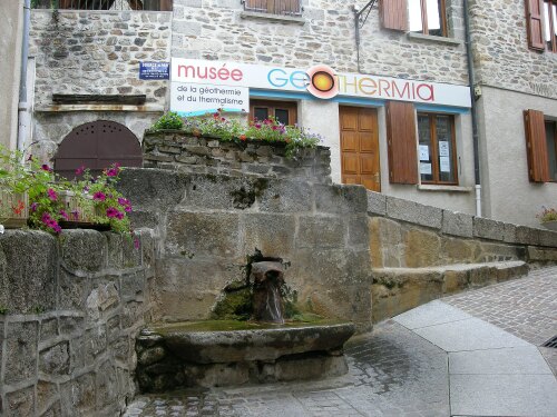
In your trip to Chaudes-Aigues you can do therms, casinos around France.
.
More details about Chaudes-Aigues in France (FR)
It is the capital of canton of Chaudes-Aigues.
It is located in time zone UTC+01:00 (in standard time).
Population of Chaudes-Aigues is 886 residents, related to 2017 latest census. Chaudes-Aigues zip code is 15110, for this reason, for post delivery on your travel it can be used the post code as described above.
Its dimension is 53 km2, ideal for people who like medium-sized cities, in our opinion a place worth visiting. In this town you can save money due to their economic room prices, and this is why you can use it as base if you want to visit all France or Chaudes-Aigues near places.
Chaudes-Aigues elevation above mean sea level, basically meters above mean sea level (MAMSL) is about 637 meters above sea. For this reason this city is a perfect travel destination if you want tall ground to see in your next travel or are willing to do winter sports when you are on a trip in a new place.
Near Chaudes-Aigues you can find for example cities like Anterrieux, Deux-Verges, Espinasse, Jabrun, Maurines, Neuvéglise, Saint-Martial. Because of this you and your family may easily go to these other wonderful destinations to see other destinations in France.
Chaudes-Aigues things to do and activities: best trip destination for:
Interactive Chaudes-Aigues (France) Map and attractions
Interactive map of Chaudes-Aigues, Auvergne-Rhône-Alpes Cantal France (FR).
