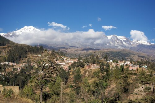
Info about Sorata, (Bolivia)
Alternate names are Sorata, Surata, suo la ta, 索拉塔, latitude is -15.7730500, and longitude is -68.6497300.
In Sorata live 2.217 people, this area timezone is America/La_Paz (America/La_Paz_cet).
Things you can do if you travel to Sorata are canoeing, biking, trail running, rafting, kayaking, paddle, abseiling, climbing, docks, beaches, countryside, hiking trails, hiking, walking trails, mountains, water sports, slopes, off-road trails, skydiving, festival, running, forest, horse trails, nightlife, islands, amusement parks, volcanoes, museums, geological formations, rivers, nature, monuments, religious sites, wildlife, scenic roads, towers, gardens, valleys, nature reserves, caves, events, clubs, bars, natural places, lakes, adventure, castles, cathedrals, water parks, historical sites in Bolivia.
.
More details about Sorata in Bolivia (BO)
It is the capital of Larecaja Province.
In Sorata live 2.217 people, according to 2001 census.
Its height above mean sea level, or meters above mean sea level (MAMSL) should be around 2700 mt. This is why this is an ideal destination if you and your beloved ones want high areas to visit in your next vacation or are willing to do climbing if you are going in a new country.
Sorata things to do and activities: best trip destination for:
Interactive Sorata (Bolivia) Map and attractions
Interactive map of Sorata, Bolivia (BO).
