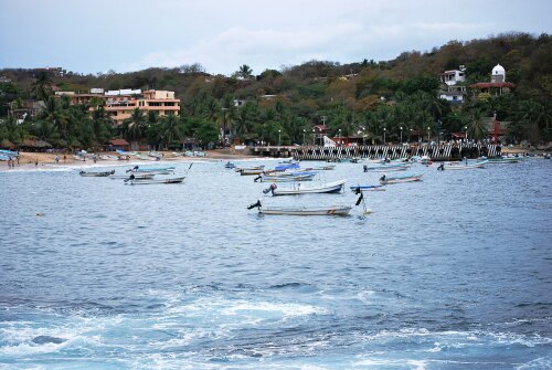
Info about Puerto Ángel, Estado de Oaxaca (Mexico)
Puerto Ángel region is Estado de Oaxaca, located in Mexico (MX).
Alternate names are Port Angeles, Puerto Angel, Puerto Ángel, latitude is 15.6689800, and longitude is -96.4909500.
In Puerto Ángel are located 2.440 citizens, its timezone is America/Mexico_City (America/Mexico_City_cet).
Popular things to do in Puerto Ángel are beaches, swimming around Mexico.
.
More details about Puerto Ángel in Mexico (MX)
Located in time zone UTC−06:00 (for standard time).
You want to dial local phone numbers. You can use 958 as local dialing code for calling local phone numbers. It’s zip code is 70902, so if you want to send anything to friends via post from Puerto Ángel this can be done by using the post code as explained.
Its elevation above mean sea level technically meters above mean sea level (MAMSL), should be about 20 mt. This is why this city is an ideal destination when you and family want flat areas to visit in your next trip.
If you’re looking for more detailed information on this city go to their website http://www.sanpedropochutla.gob.mx/.
Puerto Ángel things to do and activities: best trip destination for:
Interactive Puerto Ángel (Mexico) Map and attractions
Interactive map of Puerto Ángel, Estado de Oaxaca Mexico (MX).
